


They’re all around you: metal circles in the pavement, spikes in phone lines, grates in the grass. We don’t always understand or think about survey benchmarks, which are objects that mark specific points on the Earth, but they are the blueprint that surveyors have used to structure our built environments and coordinate systems within tidy geometric standards.
Various agencies create survey benchmarks for their purposes. The National Geodetic Survey (NGS) sets the national coordinate system to facilitate mapping and transportation planning. State agencies such as the Department of Natural Resources (DNR) and Washington State Department of Transportation (WSDOT) also assist.
“Benchmarking” is the hobby of discovering survey benchmarks. Like geocaching, a well-established hobby in Whatcom County, it often involves logging finds online. The popular geocaching site by Groundspeak stopped featuring benchmarking in 2022, but related sites such as Waymarking include listings for survey monuments and other exciting local landmarks to discover.
The appeal of benchmarking is much like geocaching. It transforms our relationship with the landscape of built environments around us. Benchmarking draws our attention to the scenery we often overlook, opening our eyes to another world hidden in plain sight. Get outdoors and survey the scene in Bellingham to learn more about benchmarking.
City of Bellingham Resources
The City of Bellingham offers a web overview of Survey Data and Information. They provide instructions on getting permission to remove or destroy monuments for construction and a Survey Monument Lookup Tool with a complete city map.
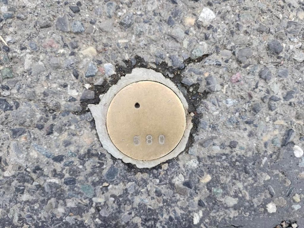
As the map shows, nearly every right-of-way in Bellingham includes a “brass monument” at the intersection of roads. These are each marked with ID numbers corresponding to their listing on the site, and sometimes also years of origin and land surveyors’ certificate numbers. They are by far the most common type of monument, but you should always take care to view them only from the sidewalk or when it is safe to cross.
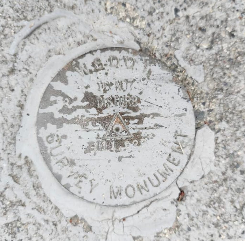
Other monument types include railroad spikes (often on telephone poles), boat spikes, iron pipes, concrete monuments, bolts, aluminum caps in the pavement, and cased monuments underneath latches. The map listings specify whether a particular monument is okay, damaged, destroyed, missing, or buried.
The “site photos” options under many listings allow visitors to download photos of monuments and the original whiteboards where land surveyors have provided background information on each monument.
You can use this map as a walking tour by viewing each listing’s written description of where benchmarks are in relation to the sidewalk, intersections, and other physical features of your surroundings.
Notable Bellingham Benchmarks
Bellingham’s rarest and most exciting benchmarks to discover include the broad “benchmark” and “traverse point” groupings, plus “donation land claim,” “plat line,” and “cadastral survey reference point NGS” types.
The benchmark and traverse point types include brass monuments, bolts, railroad spikes, and others. More specifically, they include WSDOT and State of Washington monuments of all kinds in the pavement of overpass bridges and other transportation infrastructure.
The donation land claim type mainly includes brass and concrete monuments, typically handled through agencies such as the DNR.
Plat lines are often brass monuments like those in each right-of-way, but they frequently mark the former boundaries of Bellingham’s original four towns.
Cadastral survey reference point monuments are commonly aluminum caps or cased monuments. They feature the most elaborate illustrations of cities, mountains, and other features on both their grates and the monuments beneath, typically including the words “control monument” and years of origin. NGS monuments in Bellingham include Post Point in Fairhaven, Bloedel Donovan Park, the top of the Commercial Street Garage and Mezzanine, and the Bellingham International Airport parking lots.
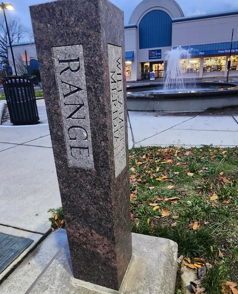
Photo credit: Anna Diehl
Drawing the Lines in Whatcom County
Whatcom County has recognized the historic influence of surveyors in other subtle ways just under our noses. Fountain District, the historic starting point of the Guide Meridian, features a Land Surveyors Association of Washington monument (marble sculpture) commemorating the 200th anniversary of the Land Ordinance of 1785. Lynden Heritage Museum displays plaques about historic surveyors and how Lynden was built along the road.
As the waymarking site listings show, Bellingham also features stone boundary markers with educational text along the original lines of Whatcom, Sehome, Bellingham, and Fairhaven. Today’s surrounding towns have benchmarks of their own, and Canadian benchmarking continues over the borders with Blaine, Lynden, and Sumas, as tall stone monuments lie on the international boundary lines.
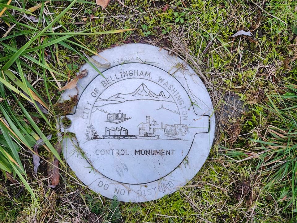
Photo credit: Anna Diehl
The NGS website features maps and databases, allowing users to locate and identify benchmarks anywhere in the United States.
When looking for benchmarks, always follow instructions not to disturb them and leave them exactly as you found them. Your cooperation will ensure that surveying agencies can continue using these monuments to put together the orderly world built all around us.


