


Each autumn and winter in the Pacific Northwest, it can seem like the rain and grey skies will never end. Sometimes, the precipitation doesn’t stop until the soil is so saturated that it gives way, causing landslides capable of causing death and destruction.

During the early morning hours of October 27, 2024, intense rainfall led to a small landslide that completely blocked the northbound lanes of Interstate 5 for hours, causing enormous traffic backups. For some, it conjured memories of prior local landslides, including one that blocked the Mt. Baker Highway east of Deming in January 2009, and damaged a home.
In the fall of 2003, rounds of record rainfall unleashed numerous landslides along the North Cascades Highway in Eastern Whatcom County. These slides caused millions of dollars in damage to roadways and infrastructure, and briefly cut off the tiny community of Diablo from the rest of the world.
“As Big as Volkswagens”
Between Thursday, October 16 and Friday, October 17, 2003, a significant fall storm hit Western Washington, dumping up to 10 inches of rain in places. The result in many areas was flooding, and Lieutenant Governor Brad Owen declared a state of emergency in Whatcom and Skagit Counties. Such a responsibility normally falls to the governor himself, but Gary Locke was traveling abroad at the time.
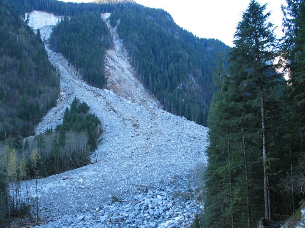
In Eastern Whatcom County near the company towns of Newhalem and Diablo, a landslide near Pyramid Creek washed out a 150-foot section of the North Cascades Highway (State Highway 20), causing what would become the highway’s earliest-ever seasonal closure. The cause of the slide was likely from a 6-foot-diameter highway culvert filling with rocks, a Washington State Department of Transportation spokesperson told the Bellingham Herald at the time.
Heavy rain persisted into the weekend, and by Monday, October 20, trees and rocks (some of the latter “as big as Volkswagens,” according to the DOT spokesperson) littered Highway 20. DOT maintenance crews removed up to 200 dump truck loads of debris alone between Marblemount and Newhalem in order to reopen that section of highway, the Seattle Times reported. In some places, debris was 10 to 15 feet deep.
People also became stranded. Two men who attempted to check on their cabin northeast of Marblemount were rescued on October 20 by National Park Service rangers, having spent more than 16 hours stranded by high water. Some weren’t as lucky: In Snohomish County, 32-year-old Patrick Connelly was killed when he stepped on a downed power line while trying to extinguish a grass fire.
On October 20, the National Weather Service recorded an all-time single-day record for precipitation at Seattle-Tacoma International Airport of 5.02 inches of rain, smashing the old record from 1959 by more than 1.5 inches. The record still stands today.
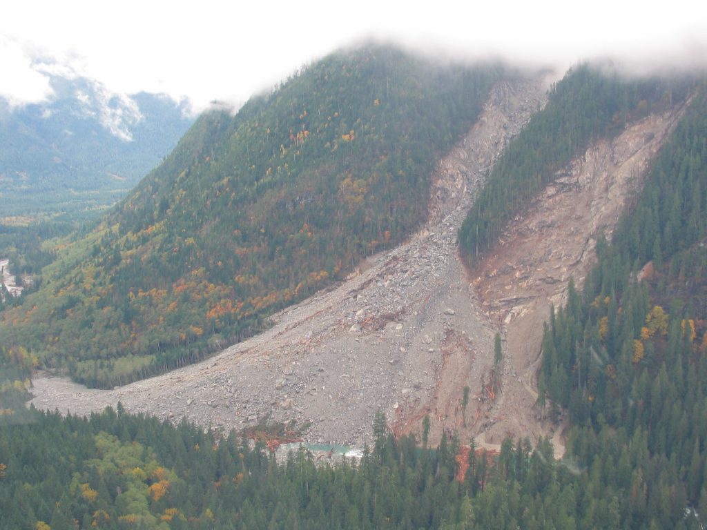
Around October 27, an enormous landslide occurred when an eastern slope of Trappers Peak gave way and fell into Goodell Creek, just west of Newhalem. While the slide did not reach Highway 20, it dammed the creek with plenty of rock and wood debris.
“Like Popcorn in a Wind Tunnel”
By the end of October, damage to roads, trails, and structures inside North Cascades National Park was estimated around at least $1.7 million, with the possibility that full repairs would take months or even years. And Mother Nature did not stop there.
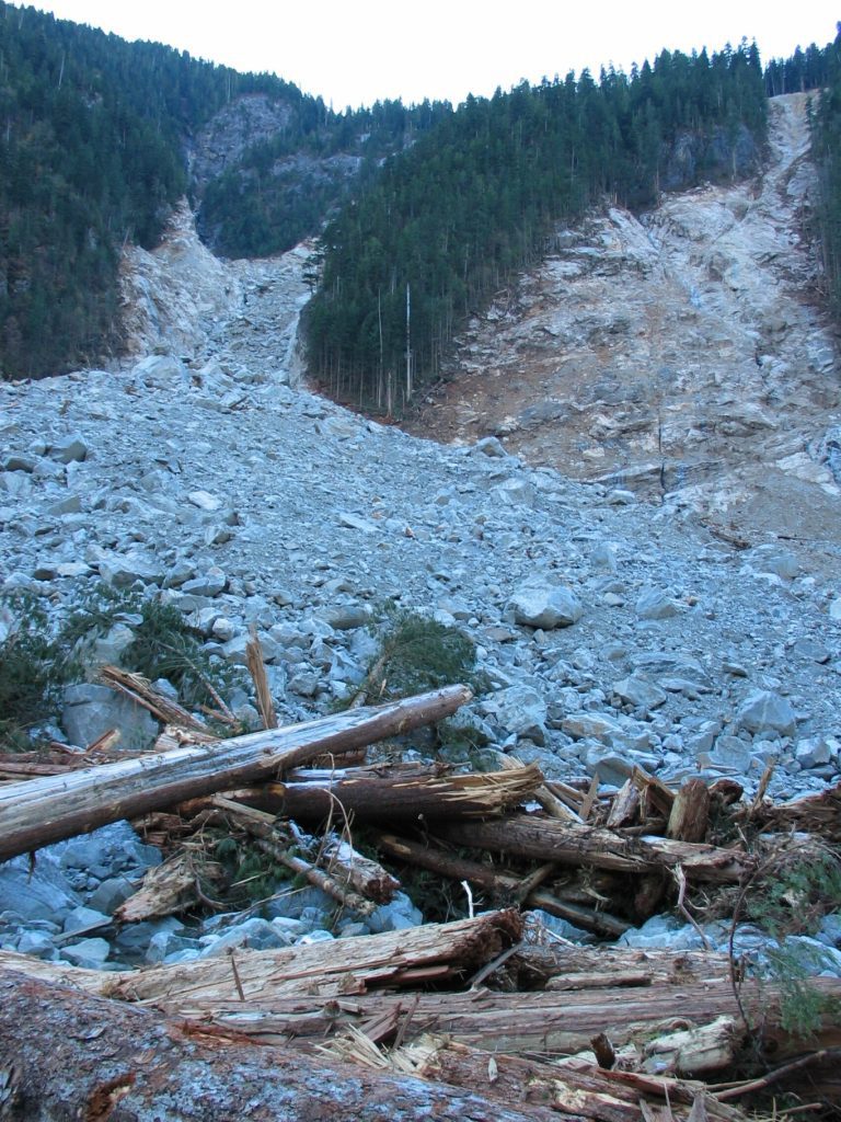
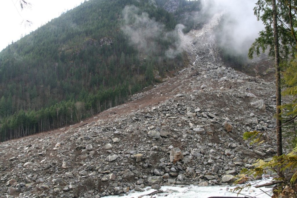
On the morning of Sunday, November 9, an estimated three million cubic yards of rock fell east of Newhalem between Afternoon and Fall Creeks, blocking another portion of Highway 20. The multiple weeks of bad weather had created conditions ripe for such a slide: a rain gauge approximately 4 miles from the site recorded 17 inches of rain between October 16 and 21, according to a 2006 research paper about the event.
As described by former Seattle Times reporter and current Cascadia Daily News editor Ron Judd, the slide created house-sized boulders “tossed about like popcorn in a wind tunnel.” The total rock mass was roughly 1,000 feet wide, 1,000 feet long and 100 feet thick, sweeping down to fill the Afternoon Creek drainage area with rubble up to 100 feet deep, Judd wrote.
Road access to Diablo, already eliminated from the east due to Highway 20’s seasonal closure, left the community totally cut off and roughly half of its 70 Seattle City Light employee-residents unable to leave. The further pummeling of Highway 20 generated additional concern for the company, as the roadway served as a critical construction and maintenance route for powerhouses of the company’s three nearby dams: Ross, Diablo, and Gorge.
By mid-week, road crews had dynamited an incredible 50-ton boulder to carve a single-lane emergency road to Diablo. With more giant rock mass still perched precariously above the highway, the danger was considered very high.
Helicopters were needed to shuttle in fresh supplies and evacuate children of workers who’d normally bus to school in nearby Concrete; the children stayed with friends or family temporarily so they could continue to attend school.
On November 17, Seattle mayor Greg Nickels visited the Newhalem area, seeing the damage firsthand. But even then, the area’s forecast would not provide respite, calling for another 5 to 10 inches of rain in just 36 hours.
Two days later, on November 19, additional slide activity damaged the one emergency access lane available to Diablo. By the next afternoon, road crews had moved another 1,500 cubic yards of debris to re-clear the access road to Diablo. Small debris slides in the area continued into December.
Future Slide Prevention
The portion of the North Cascades Highway between Newhalem and Diablo remained closed until December 18, 2003. Even after, it would be open only to Diablo residents, their immediate families, National Park Service employees, and road crews.
The following February, a March 22 public re-opening was announced for the previously-pulverized six-mile stretch of Highway 20. The full highway would re-open to traffic on April 8, 2004, but the effects of the 2003 slides would linger.
In the area between Afternoon and Fall Creeks, flaggers intermittently restricted Highway 20 to one lane into the fall of 2005, while workers completed a $13 million state project to protect the road from future rockslides. It was finally completed in December 2005.


